White Mountain Wilderness- Camp night 10
I made the 6.5 hour drive up to Ruidoso this week to see the White Mountain Wilderness.
What is an wilderness?
Wikipedia has this to say:
These areas are closed to all wheeled traffic. No cars, no jeeps, no tractors, no dirt bikes, no mountain bikes. Trail maintance crews cannot even use wheel barrows. One can walk, paddle, or ride a horse in a wilderness area.
Did three days, two nights on the South Fork and Bluefront trails.
Getting there... Long drive, but I love the empty land of West Texas and New Mexico.
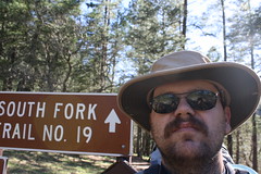
Feel free to click the tiny photo to see a normal sized verson in Flickr.
My last few hikes have been in the desert, so it was nice to get out to some place wet... though I'm not used to getting my feet wet.
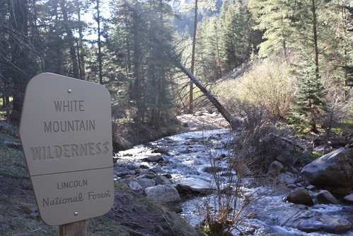
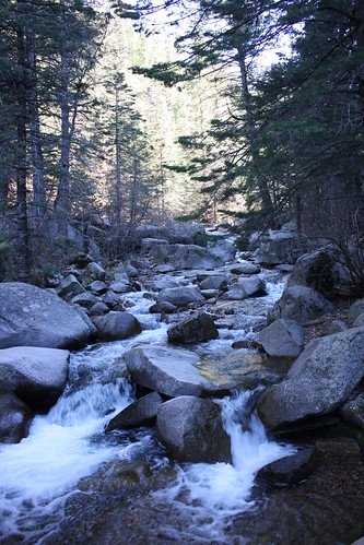
I got a late start in Texas, so I didn't get to the trail head until nearly five PM. I quickly made some last minute changes to my pack and walked about 1.5 miles down the trail to find a spot for the night. In my hurry at the car I managed to leave my tortillas and the fuel for my alcohol stove I wanted to test.
Being so late in the day, and with no other cars parked at the trail head, I didn't bother getting too far off the trail for the first camp.
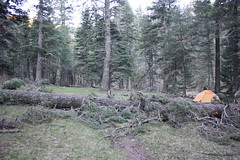
For this trip I bought a cheap junior dome 6x5 tent. Cost a whole $15, and is almost as light as my cheap tarp. I thought the protection from bugs would be nice. This is also the first of many blown down trees I'd have to crawl over, under, or around.
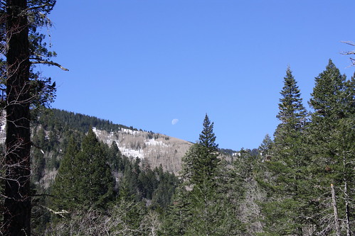
The next morning was about 40 F, and I didn't bother firing up the canister stove for breakfast. Nibbled on a couple of Chex Mix bars while breaking camp.
The plan was to hike to the end of the South Fork trail (#19) climb up the crest (10,595 ft) and come down the Bluefront trail (#33.) There isn't much water on the Bluefront trail, other than at either end, but I figured with a full day to hike, that I would end near where the water on the lower end of Bluefront begins.
Of course, it didn't quite work out that way.
South fork has had it kinda rough. A flood a year or two ago, and more than a few trees blown down. Quite a few must have happened fairly recently, as that the leaves on them are still green. Also, in a couple of places the trail has been washed into the river.
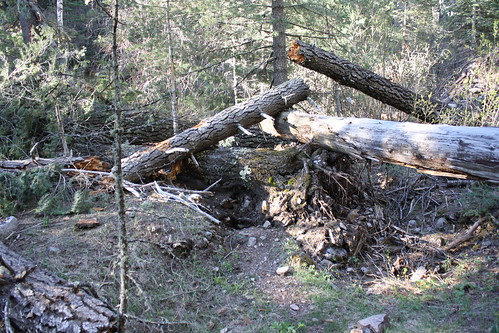
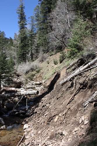
And then there was the snow. Now, I'm from Texas. I've seen snow, I've worked and driven in snow, but not what people that live in snow country would call snow. The last two miles of South Fork had some large stretches of snow. The trail would vanish for a couple hundred yards or more underneath snow sometimes several feet thick. Sometimes my wide feet would allow me to walk across it, other times I'd posthole. To post hole, is to have your legs sink into the snow while trying to walk. Later on the ridge, I'd sink to my waist in a couple of spots.
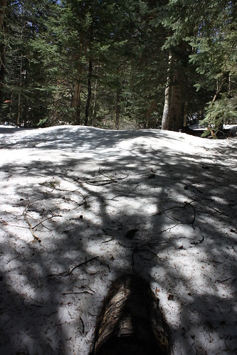
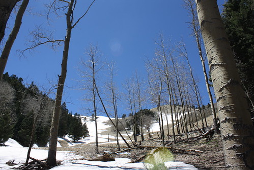
I'm going to seriously try to get back into snow country this winter and find somewhere to learn how to snowshoe, and other cool things like that.
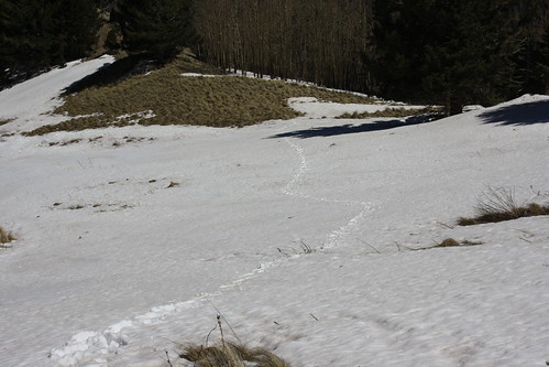
With the trail damage, having to do route finding through the snow, and it being a little steep and slick, I didn't make it to the top as quickly as I had hoped. Just the same 10,595 ft is the highest I have ever been, at least using my own feet to get there, so I was still happy.
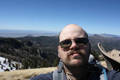
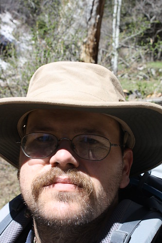
See that smile?
What is an wilderness?
* A place that is mostly biologically intact ; and,
* A place that is legally protected so that it remains wild, and free of industrial infrastructure, and open to traditional indigenous use, or low impact recreation.
Wikipedia has this to say:
The US National Wilderness Preservation System protects federally managed land areas that are of a pristine condition. It was established by the Wilderness Act (Public Law 88-577) upon the signature of President Lyndon B. Johnson on September 3, 1964. The National Wilderness Preservation System originally created hundreds of wilderness zones within already protected federally administered property, consisting of over 9 million acres (36,000 km²). As of August 2008, a total of 704 separate wilderness areas, encompassing 107,514,938 acres (435,098 km2) had been set aside.[1] With the passage of the Omnibus Public Lands Act in March 2009, there are now 756 wilderness areas.
These areas are closed to all wheeled traffic. No cars, no jeeps, no tractors, no dirt bikes, no mountain bikes. Trail maintance crews cannot even use wheel barrows. One can walk, paddle, or ride a horse in a wilderness area.
Did three days, two nights on the South Fork and Bluefront trails.
Getting there... Long drive, but I love the empty land of West Texas and New Mexico.

Feel free to click the tiny photo to see a normal sized verson in Flickr.
My last few hikes have been in the desert, so it was nice to get out to some place wet... though I'm not used to getting my feet wet.


I got a late start in Texas, so I didn't get to the trail head until nearly five PM. I quickly made some last minute changes to my pack and walked about 1.5 miles down the trail to find a spot for the night. In my hurry at the car I managed to leave my tortillas and the fuel for my alcohol stove I wanted to test.
Being so late in the day, and with no other cars parked at the trail head, I didn't bother getting too far off the trail for the first camp.

For this trip I bought a cheap junior dome 6x5 tent. Cost a whole $15, and is almost as light as my cheap tarp. I thought the protection from bugs would be nice. This is also the first of many blown down trees I'd have to crawl over, under, or around.

The next morning was about 40 F, and I didn't bother firing up the canister stove for breakfast. Nibbled on a couple of Chex Mix bars while breaking camp.
The plan was to hike to the end of the South Fork trail (#19) climb up the crest (10,595 ft) and come down the Bluefront trail (#33.) There isn't much water on the Bluefront trail, other than at either end, but I figured with a full day to hike, that I would end near where the water on the lower end of Bluefront begins.
Of course, it didn't quite work out that way.
South fork has had it kinda rough. A flood a year or two ago, and more than a few trees blown down. Quite a few must have happened fairly recently, as that the leaves on them are still green. Also, in a couple of places the trail has been washed into the river.


And then there was the snow. Now, I'm from Texas. I've seen snow, I've worked and driven in snow, but not what people that live in snow country would call snow. The last two miles of South Fork had some large stretches of snow. The trail would vanish for a couple hundred yards or more underneath snow sometimes several feet thick. Sometimes my wide feet would allow me to walk across it, other times I'd posthole. To post hole, is to have your legs sink into the snow while trying to walk. Later on the ridge, I'd sink to my waist in a couple of spots.


I'm going to seriously try to get back into snow country this winter and find somewhere to learn how to snowshoe, and other cool things like that.

With the trail damage, having to do route finding through the snow, and it being a little steep and slick, I didn't make it to the top as quickly as I had hoped. Just the same 10,595 ft is the highest I have ever been, at least using my own feet to get there, so I was still happy.


See that smile?
Comments
Post a Comment